Digital Moving Maps

Comprehensive Situational Awareness and Mission Flexibility

Digital Moving Maps (DMMs) are sophisticated avionics systems that enhance situational awareness by dynamically displaying an aircraft’s real-time position over layered, geo-referenced maps. These systems integrate data from onboard GPS, inertial navigation, and mission planning tools, providing a centralized visual interface for pilots and operators. Modern DMMs support both raster and vector map formats—including aeronautical charts, satellite imagery, and topographic data—along with GIS overlays such as airspaces, threat zones, waypoints, and restricted areas. Many platforms employ 2.5D elevation shading or integrate with synthetic vision systems to present terrain and obstacle information, helping aircrews interpret their environment with high spatial fidelity. In addition to visual navigation, DMMs serve critical roles in civil aviation, search and rescue, and ISR operations by displaying flight paths, no-fly zones, search areas, and target coordinates.


ATI DMM photo 2

Sensor Integration, Data Standards, and Tactical Relevance

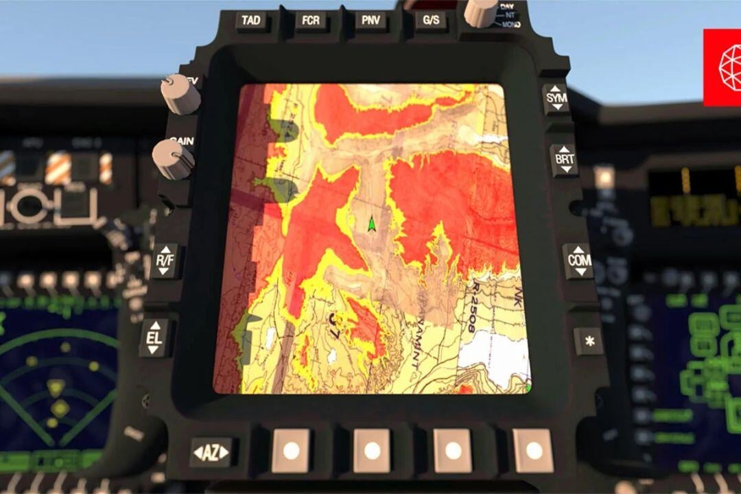
DMMs are especially valuable on ISR and SAR platforms, where they integrate with sensors like EO/IR and SAR to display real-time fields of view, sensor footprints, and designated targets. This capability allows operators to cue cameras or retask sensors directly from the map interface, significantly enhancing mission responsiveness. The systems are compatible with numerous data formats, including GeoTIFF, ECW, and JPEG2000 for raster maps, as well as SHP and VMAP for vector data. Compliance with aviation data standards like DO-200 and support for inputs such as ARINC 429 and Ethernet ensure seamless integration with avionics networks. Commonly used in tactical environments, DMMs provide accurate geo-positioning and overlay tools that support mission planning, synchronized operations, and real-time intelligence—making them essential for modern airborne operations across both civilian and military domains.

ATI DMM photo 1

Highlighted DMM Systems

Collins Aerospace Flight Management System (FMS) prod

Collins Aerospace Flight Management System (FMS)

  • Advanced DMM system integrating real-time navigation data with intuitive mission displays.

  • Optimized for rotary and fixed-wing aircraft for tactical and SAR missions.

OspreyTM Digital Map Solution (L3Harris) prod

Osprey™ Digital Map Solution (L3Harris)

  • High-performance DMM with 3D mapping, custom overlays, and real-time position updates.

  • Supports military, ISR, and SAR operations.

Thales TopOwl Digital Map Systems prod

Thales TopOwl Digital Map Systems

  • Integrated solution providing digital moving maps for enhanced situational awareness during low-altitude tactical missions.

Check our Completed Projects

Schedule a Consultation Today

With expertise in Special Mission Technologies & Solutions, I’m here to help you explore advanced systems and find the best-fit solutions for your mission-critical operations.

Mateusz Blicharz | Director, Business Development