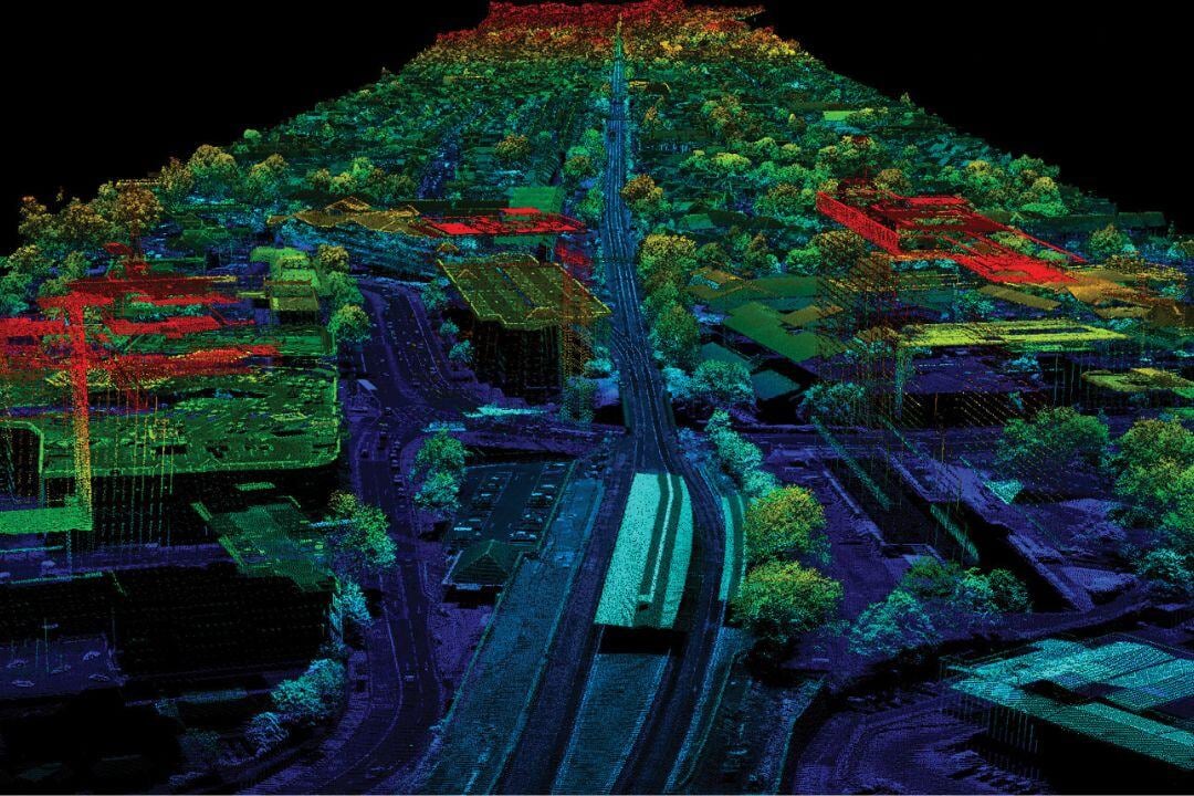
Airborne Laser Scanning (LiDAR) technology is a vital tool in aviation, enabling high-precision mapping, infrastructure assessments, and environmental monitoring. By emitting laser pulses to create detailed 3D models, LiDAR supports applications in terrain mapping, disaster response, and urban planning.
Fixed-wing aircraft cover large areas quickly, making them ideal for topographic surveys and watershed analysis, while helicopter-mounted LiDAR provides high-resolution, low-altitude scans for corridor mapping, powerline inspections, and infrastructure monitoring. When integrated with EO/IR or multispectral imaging, LiDAR enhances change detection and environmental analysis.
Despite challenges like weather dependency and complex data processing, LiDAR offers unmatched accuracy and efficiency, making it indispensable for surveying, emergency response, and infrastructure planning in modern aviation.